Mercantourman Xtrem Triathlon
Cap d'Ail / Eze / Peille, France · June · Independent (La Baroudeuse)
Why people love it
- Sea swim of 3.8 km (2.4 mi) from Cap d'Ail to Eze, then the Mercantour mountains
- Road (160 km (99.4 mi) / 99 mi) or gravel (140 km (87 mi) / 87 mi) bike option
- 2027 Traversée to Embrun every 4 years: 210 km (130 mi) road or 238 km (148 mi) gravel
Watch out for
- Fully self-supported, GPX only, no aid; 4,600 m (15,100 ft) bike climbing
- Selective entry for 2027; 50 places
- No public reviews found
Race
How racers feel about it, how well it is run, and how it treats a first timer. Counts for 27% of the overall score.
- Racer satisfactionLoved3.5
No public reviews found; a niche self-supported event of 50 places with strong adventure appeal. · Low confidence
- OrganizationAdequate3.0
Minimal support by design (GPX navigation, no marshals, no aid) with live tracking; no complaints or praise found. · Low confidence
- First timer friendlyExperts only1.0
Self-navigating, unsupported and selective: a 160 km (99 mi) bike with 4,600 m (15,100 ft) of gain, then a 42 km (26 mi) trail run. · High confidence
Course traits, not part of the score
- PR potentialVery slow1.0
The target time is 24 hours, with 4,600 m (15,100 ft) of bike gain and 2,000 m (6,560 ft) on the trail marathon. · High confidence
- Course easeExtreme1.0
A 3.8 km (2.4 mi) sea swim, 160 km (99 mi) bike with 4,600 m (15,100 ft) gain, then a trail marathon, all self-supported. · High confidence
Swim
Wetsuit odds, water temperature, calm, and the experience of the start. Counts for 15% of the overall score.
- Wetsuit legalUsually4.0
Early June Mediterranean water is about 18-19 °C (64-66 °F), below the 24.5 °C (76.1 °F) limit, but wetsuit rules were not found. · Low confidence
- Water temperatureComfortable3.9
Estimated at 18-19 °C (64-66 °F) in early June; this is not a measured figure. · Low confidence
- Calm waterMostly calm3.6
Open Mediterranean coast with no tide, usually calm at 05:30 in June, but race-day sea state is unknown. · Low confidence
- Swim easeModerate3.0
3.8 km (2.4 mi) point-to-point along the coast is simple to navigate, but the 05:30 start is dim and safety cover is unclear. · Low confidence
- Swim experienceGreat4.4
Clear Côte d'Azur water along the Cap d'Ail to Eze coastline with a small 50-person field; no participant accounts. · Low confidence
Bike
Road surface, closures, scenery and wind. Counts for 19% of the overall score.
- Road surfaceMixed3.0
Mountain roads plus a gravel option; navigation is GPX-only and there is no surface data. · Low confidence
- Road closuresMostly open1.5
Open public roads with no marshals or closures. · Medium confidence
- Bike scenerySpectacular4.8
The Mercantour hinterland, La Turbie and Sospel; no participant reports yet. · Medium confidence
- WindMostly calm3.5
Mountain relief shelters the coast, but the cols are exposed; no wind reports. · Low confidence
Course traits, not part of the score
- Bike speedVery slow1.0
4,600 m (15,100 ft) of climbing in 160 km (99 mi), or 4,000 m (13,100 ft) in 140 km (87 mi) on the gravel option. · High confidence
- Bike flatnessMountainous1.0
The official road gain is 4,600 m (15,100 ft), among the hilliest bikes of any full. · High confidence
- Bike simplicityTechnical1.6
Long mountain descents, a gravel option and self-navigation by GPX. · Low confidence
Run
Crowds, aid stations, conditions underfoot and scenery. Counts for 13% of the overall score.
- Crowd supportLonely1.0
Self-supported, with few spectators beyond Peille village. · Medium confidence
- Aid stationsSparse1.0
No aid stations or feeding zones, and outside resupply is not allowed. · High confidence
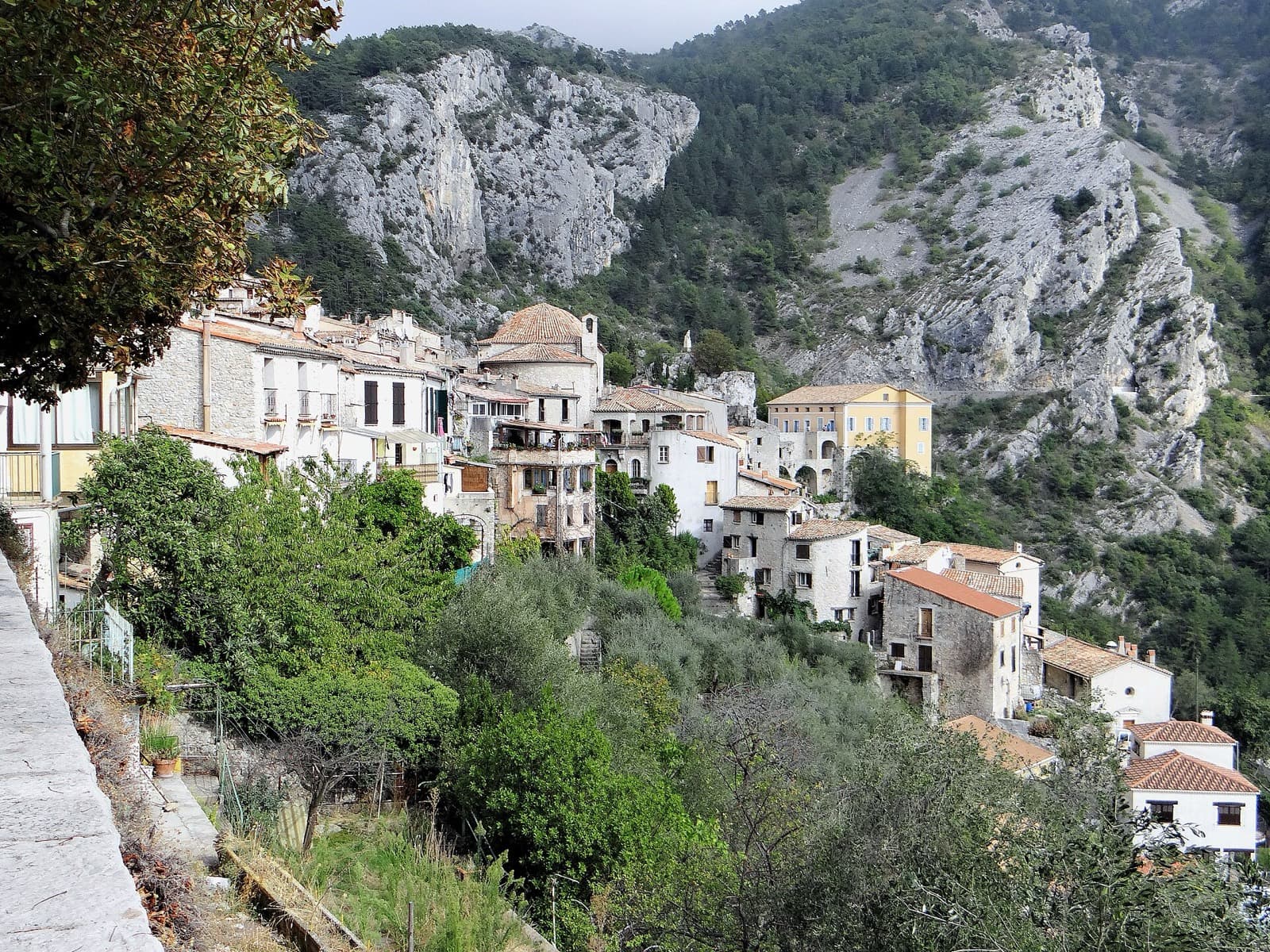
- Run sceneryBeautiful4.2
A trail around the perched village of Peille with Mediterranean views; not independently reported. · Low confidence
- Run conditionsBrutal1.2
A trail marathon after 160 km (99 mi) of mountain biking, with no aid and possible June heat. · Medium confidence
Course traits, not part of the score
- Run flatnessBig climbs1.2
2,000 m (6,560 ft) of gain over 42 km (26 mi), run as two 21 km (13 mi) loops from Peille. · High confidence
Conditions
Air temperature, how predictable the weather is, setting, and spectating. Counts for 15% of the overall score.
- Air temperaturePleasant3.6
Early June in the Riviera hinterland is roughly 18-27 °C (64-81 °F) by day, cooler at altitude and at night, over a long 24-hour exposure. · Low confidence
- Weather reliabilityVariable3.4
June on the Mediterranean is generally stable, but hinterland thunderstorms occur; no race-day reports. · Low confidence
- Venue beautyStunning4.7
Riviera coast leading into Mercantour national park. · Medium confidence
- Spectator friendlyHard to watch1.4
A dispersed course with no spectator provision; only the start and finish are accessible. · Medium confidence
Course traits, not part of the score
- Low altitudeLow3.6
Starts at sea level and finishes at Peille, about 400 m (1,300 ft); the 2027 Traversée reaches about 2,700 m (8,860 ft). · Low confidence
Stay and travel
Hotels, walkability, getting there, and the town around the race. Counts for 11% of the overall score.
- Hotel availabilityBook early2.8
The Monaco, Nice and Eze area has plenty of rooms, but June is high season; unverified. · Low confidence
- Hotel valuePricey1.8
Riviera accommodation is expensive. · Low confidence
- WalkabilityMostly driving2.2
The swim ends at Eze and the finish is at Peille, separate sites about 15 km (9 mi) apart. · Low confidence
- Travel easeVery easy4.6
Nice Côte d'Azur airport is about 20 km (12 mi) away and is a major international hub. · Medium confidence
- LogisticsFiddly2.0
Two transition sites, mandatory GPS tracking and self-sufficiency mean heavy gear logistics. · Medium confidence
- Town and foodGood4.3
Eze, Monaco and Nice offer great food, though not race-specific. · Low confidence
Key facts
- Location
- Cap d'Ail / Eze / Peille, Alpes-Maritimes, Provence-Alpes-Cote d'Azur, France
- Typical month
- June
- Latest or next date
- 18 June 2027
- Organiser
- Independent (La Baroudeuse)
- Field size
- About 50 athletes
- Entry fee
- About $300
- Distances
- 3.8 km (2.4 mi) swim, 180 km (112 mi) bike, 42.2 km (26.2 mi) run
- Cutoffs
- Finish 24h target (2024-26); 2027 Traversee 24h road / 41h gravel
- Swim venue
- Cap d'Ail (Plage de la Mala) to Eze bord de mer (Port Silva Maris) (ocean)
- Swim start
- mass
- Swim laps
- 1
- Bike climbing
- 4,600 m (15,090 ft)
- Bike laps
- 1
- Key climbs
- La Turbie; Sospel
- Run climbing
- 2,000 m (6,560 ft)
- Run laps
- 2
- Nearest airport
- Nice (NCE), 20 km (12 mi) away
- Where to stay
- Eze, Monaco, Nice
Sources
Pages we used for facts and ratings. See how we rate.
Training for Mercantourman Xtrem Triathlon? Moku Coach builds your plan around race day.