Pinhoti 100
Heflin to Sylacauga, Alabama · November · 100 mi
- Distance
- 100.4 mi (162 km)
- Point to point
- Climbing
- 4,267 m (14,000 ft)
- Hilly: 26 m per km (139 ft per mi)
- Overall cutoff
- 32 hours
- 19:06 per mi (11:52 per km) average
- Finish rate
- 77%
- of starters in 2025
Why runners love it
- True point-to-point 161.5 km (100.4 mi) from Heflin to Sylacauga over Cheaha Mountain, 734 m (2,408 ft).
- 17 aid stations, longest gap 12.9 km (8 mi), with themed stations and returning volunteers.
- One pacer at a time from mile 43.5 (70.0 km); crew reach 10 of 17 stations.
- 83 mi (134 km) of singletrack, much of it soft pine needles, with rocky ridges and creeks.
- Western States qualifier with a 32 h limit and a buckle for every finisher.
Watch out for
- Every station has a printed cutoff that tightens for the back of the pack; times ignore terrain.
- Drop bags at 5 stations only, handed in at Friday packet pickup, 3 to 7 PM.
- Cold, windy night after Pinnacle: -3 °C (27 °F) with 32 to 48 km (29.8 mi)/h (20 to 30 mph) gusts.
- Sold out with a waitlist; buses leave the finish at 3:45 AM and crews follow odd or even rules.
- The race clock ignores the time change, so ask stations for race time.
Race
How runners feel about it, how well it is run, and the community around it. Counts for 25% of the overall score.
Toughness for its distance: Very tough
- Runner satisfactionLoved4.4
Reports from 2014 to 2021 are strongly positive and a first-timer gave 5 of 5; complaints are limited food and tight cutoffs. · Medium confidence
- OrganizationWell run4.3
Detailed manual with cutoffs, crew and drop bag rules, chip timing, buses and about 200 volunteers; the printed aid chart has typos. · Medium confidence
- Community and vibeLegendary4.5
Family-run for about 22 years with themed aid stations, returning volunteers and night bonfires. · Medium confidence
Support
Aid stations, crew access, drop bags and pacer rules. Counts for 25% of the overall score.
- Aid stationsGood4.1
17 stations, longest gap 12.9 km (8 mi), two water-only; hot food from mile 40 (64 km), though a 2021 runner found food limited. · Medium confidence
- Crew accessGood3.7
Crew reach 10 of 17 stations and the finish, but one vehicle per runner and odd or even bib splits at four. · High confidence
- Drop bagsSome stations3.4
Bags allowed at 5 stations about 24 km (15 mi) apart, but only handed in at Friday packet pickup. · High confidence
- PacersMuch of the race4.4
One pacer at a time from Aid 7 (mile 43.5, 70.0 km (43.5 mi)), more than half the race, with seven pickup points. · High confidence
Course
Course marking, scenery, and how runners rate the trail itself. Counts for 15% of the overall score.
- Course markingClear4.4
Blue flags, reflectors and sentries at road crossings; no reports of widespread lost runners, and cutting the course is a disqualification. · Medium confidence
- SceneryBeautiful4.3
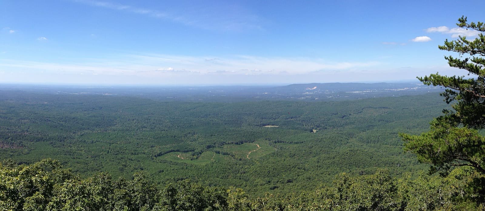
Talladega National Forest ridgelines, views from Cheaha Mountain at 734 m (2,408 ft) and fall colour. · Medium confidence
- Trail experienceGreat4.3
Runners praise 134 km (83 mi) of soft pine-needle singletrack; rocky jeep roads and a slow early conga line are the downsides. · Medium confidence
Course traits, not part of the score
- FootingModerate2.8
Rocky, creek-filled singletrack and rock-strewn jeep roads plus a boulder descent, but mostly soft pine needles and no scrambling. · Medium confidence
- RunnabilityMixed3.3
Fast singletrack early, then long steep climbs and descents; a 2014 runner called the finish runnable. · Medium confidence
- ClimbingRolling hills2.9
Climbs 140 ft per mi (26 m per km), from the official elevation gain. · High confidence
Conditions
Race-day temperature and how predictable the weather is. Counts for 14% of the overall score.
- Race-day temperaturePleasant3.8
Early November, roughly -4 to 21 °C (24 to 70 °F); a cold, windy night on Horn Mountain after the Pinnacle aid. · Medium confidence
- Weather reliabilityReliable3.9
Never cancelled for weather and rain-free in 15 of 17 years, but cold snaps to -3 °C (27 °F) and wind have hit. · Medium confidence
Course traits, not part of the score
- AltitudeLow4.4
High point is Cheaha Mountain at 734 m (2,408 ft), well under 1,500 m (4,900 ft). · High confidence
Cutoffs
How generous the overall and intermediate cutoffs are for the terrain. Counts for 13% of the overall score.
- Overall cutoffNormal3.3
32 h for 161.5 km (100.4 mi) with 4,267 m (14,000 ft) is about 19 min per mile (12 per km); median 28:44. · High confidence
- Intermediate cutoffsReasonable3.0
Every station has a cutoff at about 18 to 19 min per mile (11 to 12 per km); back-of-pack runners say they ignore terrain. · Medium confidence
Intermediate cutoffs (2026)
| Where | Distance | Cutoff |
|---|---|---|
| Aid 1 High Rock, mile 7.0 | 11 km (7.0 mi) | 8:07 AM (2:07 elapsed) |
| Aid 2 Shoal Creek, mile 13.8 | 22 km (14 mi) | 10:09 AM (4:09 elapsed) |
| Aid 3 Horseblock, mile 18.8 | 30 km (19 mi) | 11:39 AM (chart prints PM) (5:39 elapsed) |
| Aid 4 Hwy 431, mile 23.24 | 37 km (23 mi) | 12:59 PM (6:59 elapsed) |
| Aid 5 Morgan Lake, mile 28.24 | 45 km (28 mi) | 2:29 PM (8:29 elapsed) |
| Aid 6 Blue Mtn, CC Road, mile 36.24 | 58 km (36 mi) | 4:53 PM (10:53 elapsed) |
| Aid 7 Cheaha Lake, mile 43.52 | 70 km (43 mi) | 7:30 PM (13:30 elapsed) |
| Aid 8 Silent Trail, mile 45.92 | 74 km (46 mi) | 8:39 PM (14:39 elapsed) |
| Aid 9 Hubbard Creek, mile 52.74 | 85 km (53 mi) | 10:49 PM (16:49 elapsed) |
| Aid 10 Adams Gap, mile 57.14 | 92 km (57 mi) | 12:13 AM (18:13 elapsed) |
| Aid 11 Clairmont Gap, mile 62.14 | 100 km (62 mi) | 1:49 AM (19:49 elapsed) |
| Aid 12 Chandler Springs, mile 67.29 | 108 km (67 mi) | 3:28 AM (21:28 elapsed) |
| Aid 13 Porters Gap, mile 70.63 | 114 km (71 mi) | 4:31 AM (22:31 elapsed) |
| Aid 14 Pinnacle, mile 76.38 | 123 km (76 mi) | 6:21 AM (24:21 elapsed) |
| Aid 15 Heath Cliff / Wormy's Pulpit, mile 81.38 | 131 km (81 mi) | 7:57 AM (25:57 elapsed) |
| Aid 16 Bulls Gap, mile 87.98 | 142 km (88 mi) | 10:03 AM (28:03 elapsed) |
| Aid 17 Watershed 609-A, mile 95.88 | 154 km (96 mi) | 12:34 PM (30:34 elapsed) |
| Finish, Sylaward Trail (Lake Howard), mile 100.38 | 162 km (100 mi) | 2:00 PM (32:00 elapsed) |
Not part of the score
- First timer friendlyDoable3.1
The race says it is not a first-timer course, yet many first 100s finish; frequent aid helps, tight cutoffs do not. · Medium confidence
- Getting inSells out2.5
Open entry with no qualifier, but 2026 sold out with a waitlist and demand stays high as a Western States qualifier. · Medium confidence
Stay and travel
Getting there, places to stay, race-day logistics and value. Counts for 8% of the overall score.
- Travel easeFair3.0
Birmingham is about 82 km (51 mi) from the finish per the race manual; the start is a separate campground reached by bus. · Medium confidence
- Places to stayGood3.7
Hotels within 15 minutes of the finish, $10 per night camping at the finish and free primitive camping in Heflin. · Medium confidence
- LogisticsSome complexity2.6
Point to point: packet pickup only on Friday, 3:45 AM buses from the finish ($20) and odd or even crew rules. · Medium confidence
- ValueFair3.3
$447 with fees for 161 km (100 mi), 17 aid stations and a buckle; the finish-to-start bus costs extra. · Medium confidence
Key facts
Checked against the 2026 edition on the official race site. Rules change, so confirm before you enter. Blank means the race does not publish it.
- Location
- Heflin to Sylacauga, Alabama, United States
- Region
- Southeast US
- Typical month
- November
- Latest or next date
- 7 November 2026
- Start time
- 06:00
- First held
- 2008
- Distance
- 100.4 mi (162 km)
- Course shape
- Point to point
- Surface
- Trail: Official page splits the course into 83 mi (134 km) singletrack, 17 mi (27 km) jeep road and 2 mi (3 km) pavement, which adds to 102 mi (164 km) against a 100.38 mi (161.5 km) course length. Pine Glen Campground (Heflin) to Lake Howard at the Sylaward Trailhead (Sylacauga), over Cheaha Mountain. Reports describe soft pine-needle singletrack and rocky jeep road.
- Footing
- Official: 100.38 mi (161.5 km), just over 14,000 ft (4,267 m) of climb and the same in descent. Reports describe rocky, creek-filled singletrack, rock-strewn jeep roads, a steep boulder section descending off Bald Rock into Cheaha Lake, and a cold, exposed ridge near the Pinnacle aid. High point Cheaha Mountain 2,408 ft (734 m) per the race site.
- Elevation gain
- 4,267 m (14,000 ft)
- Climbing rate
- 26 m per km (139 ft per mi)
- High point
- 734 m (2,410 ft)
- Overall cutoff
- 32 hours
- Pace to make the cutoff
- 19:06 per mi (11:52 per km)
- Cutoff notes
- Every aid station has a printed cutoff; runners must also leave before the cutoff. Race clock does not fall back at the November time change (race time 6:00 AM CST Saturday to 2:00 PM Sunday). The chart's Aid 3 cutoff prints 11:39 pm, which is evidently a typo for 11:39 am. A 2021 report says the cutoffs do not account for terrain and tighten for the back of the pack. Elapsed times are computed from the 6:00 AM start.
- Aid stations
- 17
- Longest gap between aid
- 13 km (8.0 mi)
- Drop bags
- Some stations
- Crew access
- Many points
- Pacers
- Allowed from Aid 7 Cheaha Lake (mile 43.52, 70.0 km); one pacer per runner at a time
- Support notes
- 17 aid stations; the longest gap is 8 mi (12.9 km) from Morgan Lake (28.24 mi) to Blue Mtn CC Road (36.24 mi). Drop bags at 5 stations only: Morgan Lake (mile 28.2), Cheaha Lake (43.5), Adams Gap (57.1), Porters Gap (70.6) and Bulls Gap (88.0), dropped off at Friday packet pickup only. One crew vehicle per runner; odd bibs use Aid 1 and Aid 13, even bibs use Aid 2 and Aid 14; no crew at Aid 4, 5, 6, 9, 11, 12, 15. Pacer entry points: Aid 7, 8, 10, 13, 14, 16, 17. Cheaha State Park crew pass $5 per adult (cash, in advance). Aid has GU gels and drink, water, Coke, PB&J, chips, fruit, with soup and more from about mile 40 (64 km).
- Water crossings
- A few
- Water notes
- Official course description says runners go 'through creeks'; no count given.
- Night running
- Most runners run through one night
- Mandatory gear
- Headlamp (the first 45 minutes are in the dark); two bottles or a hydration pack is preferred. The manual says extra night-time clothing may be essential.
- Entry
- Open
- Qualifier needed
- none
- Qualifies for
- Western States
- Entry fee
- About $380
- Entry notes
- UltraSignup: $380 base ($446.64 with taxes and fees); $350 early discount from 11/23 to 12/26. 100 percent refund until March 28. No race-day registration, transfers or deferrals. Buses $20 from the finish to the start. 2026 is sold out with a free waitlist. 2025 field was 174 starters.
- Finish rate
- 77% of starters in 2025
- Air temperature
- 1–21 °C (34–70 °F)
- Weather notes
- Official manual: record high 83 F (28 C) in 1975, record low 24 F (-4 C) in 1967; rain-free in 15 of 17 years (2015 all-day rain, 2020 mist). Winds of 20 to 30 mph (32 to 48 km/h) and temps near 27 F (-3 C) seen on Horn Mountain after the Pinnacle aid. The race has never been cancelled for weather. Typical range chosen from a 43 to 66 F (6 to 19 C) average listed by a race calendar plus the extremes in the manual.
- Nearest airport
- Birmingham (BHM)
- Stay notes
- Race manual gives driving directions from Birmingham: about 51 mi (82 km) on Hwy 280 to Sylacauga. Quality Inn Sylacauga (62 rooms, discounted rate), Holiday Inn Express Sylacauga, free primitive camping in Heflin, $10 per night camping at Lake Howard (finish), Pine Glen campground at the start. UltraSignup says hotels are within 15 minutes of the finish.
- Course record (men)
- 16:24:15 David Riddle (2016)
- Course record (women)
- 19:04:46 Jacqueline Merritt (2016)
Races like this
See every race ranked by likenessClosest on distance, course shape, climbing, footing, region and season.
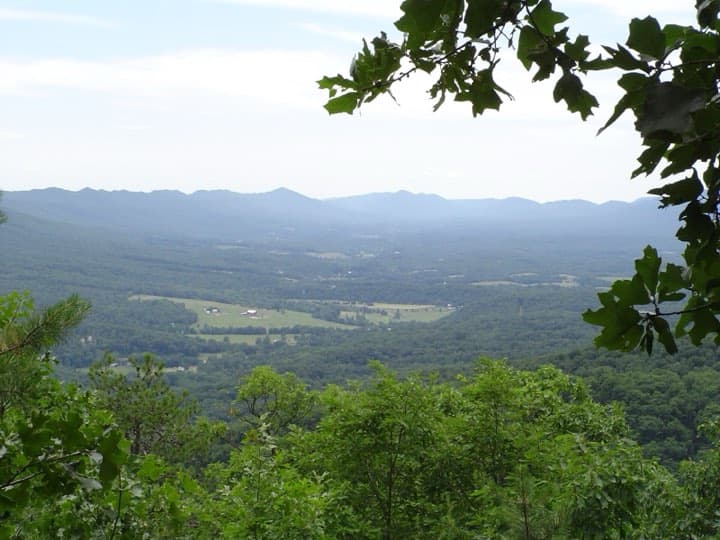
Woodstock, VA
Also 100 mi · Point to point or one big loop · Similar climbing
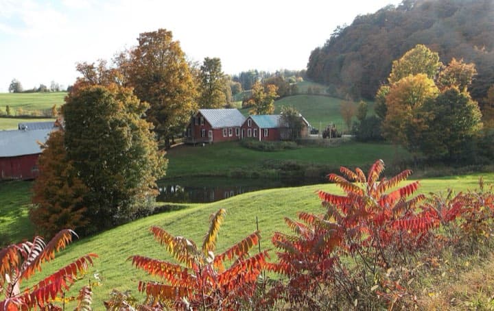
West Windsor, VT
Also 100 mi · Point to point or one big loop · Also in the Eastern US
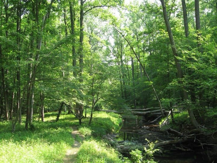
Titusville, PA
Also 100 mi · Similar footing · Also in the Eastern US
What runners and reviewers say
- TeamRunRunRaced 2021 · blog · Positive
First 100 mile finish in 29:02. About 90 percent soft pine-needle singletrack; the first roughly 10 mi (16 km) is a no-passing line. Aid about every 5 mi (8 km) with four drop-bag stations; food limited. Warns that cutoffs do not account for terrain and pacers should know the maths; mild 40 to 70 F (4 to 21 C) weather.
“Where are the real mountains?”
- Sunrise Running CompanyRaced 2014 · blog · Positive
23:45 finish. Runnable early singletrack, then long steep climbs and fast descents; started near -1 C (30 F), windy ridges felt below -6 C (20 F). Aid stations quick and well run, with a bonfire at Watershed; wife crewed and hiked with him from mile 60 (97 km).
“pure joy and absolute exhaustion”
- RunningAhead Trailer Trash forumRaced 2014 · forum · Positive
27:54 finish after a 2012 DNF; 117 of about 180 starters finished. Freezing wind of about 30 mph (48 km/h) on the Pinnacle section, rock-strewn jeep roads, a first pacer who rolled an ankle near mile 50 (80 km) and a brother who ran the final 15 mi (24 km). Aid staff said he was 90 minutes ahead of the cutoff at mile 85 (137 km).
- UltraRunning Magazinearticle · Mixed
Read via a search summary because the page blocked automated access: the writer says temperatures dropped into the 30s F (about 0 to 4 C), cutoffs tightened toward the back and one runner reached Bulls Gap with only 15 minutes to spare. A bridge repair once added 3 mi (5 km) and an hour to a late cutoff.
- The PanolianRaced 2024 · article · Mixed
Local newspaper story on a finisher: reports over 300 starters and under half finishing, which conflicts with MassUltra's 154 finishers from more than 250 starters in 2024; rocky, boulder-strewn, creek-filled terrain, 17 aid stations and a pacer who covered well over 50 mi (80 km).
Show 5 more
- MassUltraRaced 2025 · aggregator · Positive
18th annual race: 133 finishers inside the 32 hour limit, with a three-way finish between 21:39:53 and 21:39:58 and the women's race decided by 4 seconds.
- MassUltraRaced 2022 · aggregator · Positive
15th annual race: 120 finishers, winners in 19:42 and 22:49, and about 14,000 ft (4,267 m) of climbing.
- Run Spiritedarticle · Positive
Profile of directors Todd and Jamie Henderson: a family-oriented event that grew out of the 2006 Mount Cheaha 50K, with close to 200 returning volunteers and themed aid stations such as Wizard of Oz and Waffle House.
- RaceRavesRaced 2014 · aggregator · Positive
A first-time 100 mile runner rated it 5 out of 5, calling the experience magical, the trail gnarly and the volunteers and scenery great, while warning that almost half the field did not finish.
- UltraRunning Magazine (event article)article · Positive
Read via a search summary because the page blocked automated access: the writer singles out aid stations and volunteers, bonfires that keep runners warm on the cold night, and trail running through hiker camps in the dark.
Ran Pinhoti 100? Your notes on the footing, cutoffs and aid stations help the next runner decide.
Sources
Pages we used for facts and ratings.
Training for Pinhoti 100? Moku Coach builds your plan around race day.