Highlands Sky 40 Mile Trail Run
Davis, West Virginia · June · 40 mi
- Distance
- 41 mi (66 km)
- Point to point
- Climbing
- 1,668 m (5,470 ft)
- Hilly: 25 m per km (134 ft per mi)
- Overall cutoff
- 12 hours
- 17:36 per mi (10:56 per km) average
Why runners love it
- Point-to-point over Roaring Plains and Dolly Sods: 66.0 km (41 mi) with 1,668 m (5,474 ft) of climb
- Eight aid stations with real food: PB&J, soup, potatoes, soda and fruit
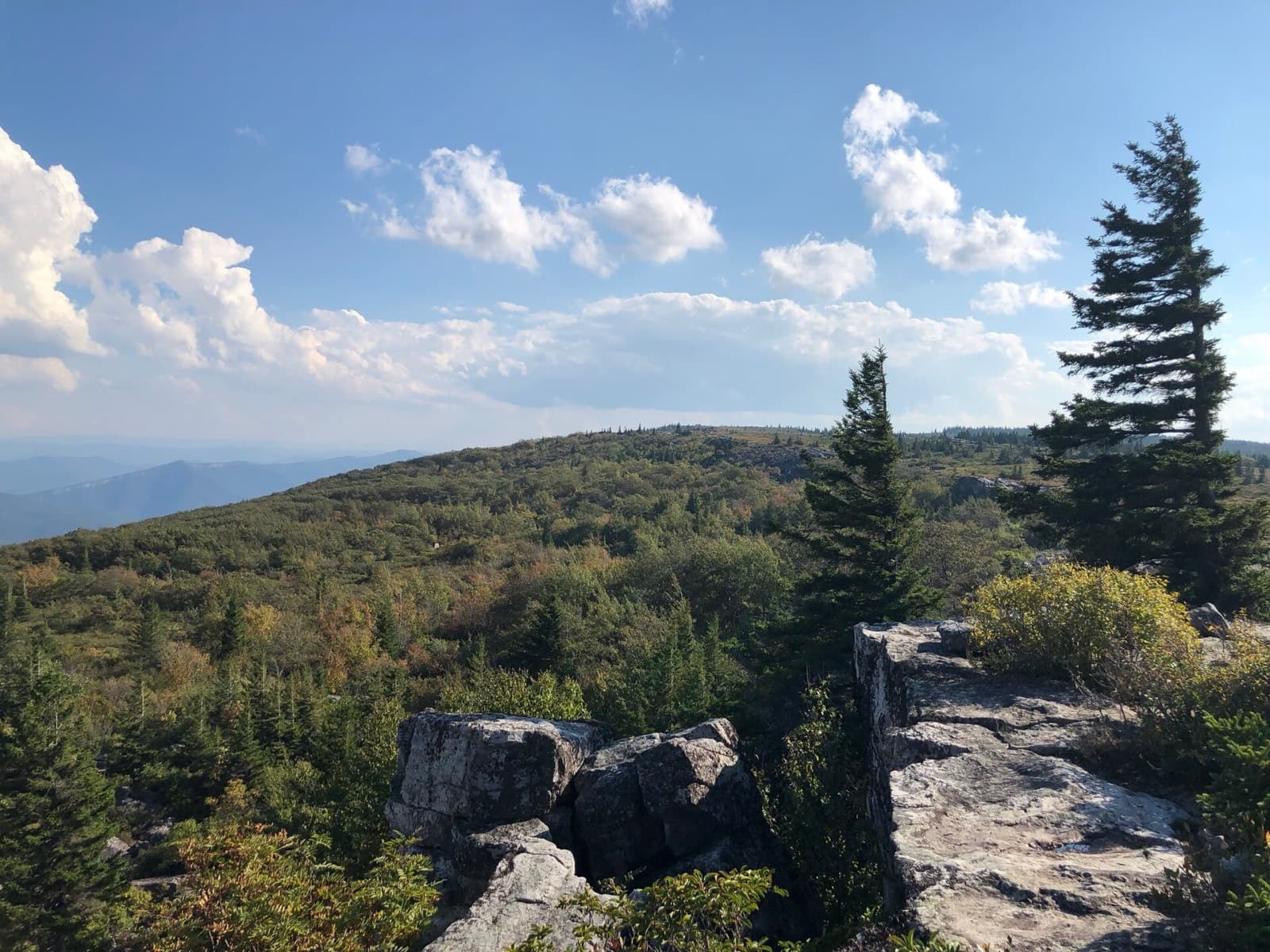
- Open plateau above 1,219 m (4,000 ft) at Bear Rocks and Dolly Sods
- Repeat runners call it a family reunion; club-run since 2003
- $140 entry includes the Friday dinner
Watch out for
- Four enforced cutoffs; the first is 3 h 15 min for 10.5 mi (16.9 km)
- Rocky technical single-track at miles 7 to 11 and 16 to 18; boulder field at miles 30 to 31
- Mud, bogs and the steep Butt Slide descent near mile 36 (58 km) slow most runners
- Crew only at miles 19.7 and 36.9; no pacers; drop bag only at mile 19.7
- Registration fills in hours on 2 February; no return shuttle, with a 05:00 bus to the start
Race
How runners feel about it, how well it is run, and the community around it. Counts for 25% of the overall score.
Toughness for its distance: Very tough
- Runner satisfactionLoved4.3
Runners call it a tough, beautiful, old-school mountain ultra and a family reunion, and many return yearly; difficulty is the main caveat. · Medium confidence
- OrganizationFlawless4.5
A long-running club event with experienced directors, good marking on the steep Butt Slide and well-stocked aid. · Medium confidence
- Community and vibeLegendary4.6
A loyal repeat field and a finish-line party; volunteers are called among the kindest, and the club has run it since 2003. · Medium confidence
Support
Aid stations, crew access, drop bags and pacer rules. Counts for 25% of the overall score.
- Aid stationsStandard3.3
Eight stations with real food, but the first is water-only and the longest gap is 8.1 mi (13.0 km); carry fluids and fuel. · High confidence
- Crew accessVery limited2.2
Crew may drive only to Aid 4 (mile 19.7, 31.7 km (19.7 mi)) and Aid 8 (mile 36.9, 59.4 km (36.9 mi)); going farther means disqualification. · High confidence
- Drop bagsSome stations2.5
Bags only at the start and Aid 4 (mile 19.7, 31.7 km (19.7 mi)); none at the Bear Rocks cutoff station. · High confidence
- PacersVery late only1.5
Pacers are not allowed; friends may join only from mile 36.9 (59.4 km) to the finish. · High confidence
Course
Course marking, scenery, and how runners rate the trail itself. Counts for 15% of the overall score.
- Course markingClear3.8
Runners call it well marked, but two runners lost the trail in Roaring Plains fog or the boulder field in different years. · Medium confidence
- ScenerySpectacular4.7
High windswept plateaus, Dolly Sods, Bear Rocks, bogs and spruce above 1,219 m (4,000 ft). · Medium confidence
- Trail experienceGreat3.9
Runners rave about the variety but also the mud, rocks and the exposed 7.5 mi (12.1 km) gravel Road Across the Sky. · Medium confidence
Course traits, not part of the score
- FootingTechnical1.5
Highly technical rocky single-track at miles 7 to 11 and 16 to 18, a boulder field at miles 30 to 31, mud and scree. · High confidence
- RunnabilityLots of hiking2.3
Described as a 40 miler that runs like a 50; the 7.5 mi (12.1 km) gravel road is runnable but exposed. · Medium confidence
- ClimbingRolling hills3.0
Climbs 133 ft per mi (25 m per km), from the official elevation gain. · High confidence
Conditions
Race-day temperature and how predictable the weather is. Counts for 14% of the overall score.
- Race-day temperaturePleasant3.7
June at 1,200 to 1,450 m (4,000 to 4,800 ft) is usually cooler than the lowlands; the race publishes no temperatures. · Low confidence
- Weather reliabilityVariable2.8
Often wet (2025 had 2 in, 5 cm, of rain the night before), with fog on Roaring Plains and flooded boardwalks. · Low confidence
Course traits, not part of the score
- AltitudeModerate3.0
Plateaus above 1,219 m (4,000 ft); one runner puts the top near 1,454 m (4,770 ft). · Medium confidence
Cutoffs
How generous the overall and intermediate cutoffs are for the terrain. Counts for 13% of the overall score.
- Overall cutoffNormal2.6
12 h for 66 km (41 mi) with 1,668 m (5,474 ft) of climb on technical ground, about 17.5 min per mile. · Medium confidence
- Intermediate cutoffsVery tight1.4
Four enforced cutoffs: 3 h 15 at mile 10.5 (16.9 km), 5 h 05, 6 h 05, then 7 h 40 at mile 27. · High confidence
Intermediate cutoffs (2026 (official WVMTR details and course pages read 2026-10-17))
| Where | Distance | Cutoff |
|---|---|---|
| Aid 2 Gas Line, mile 10.5 | 17 km (11 mi) | 09:15 (3 h 15 elapsed) |
| Aid 3 Forest Rd 70, mile 16 | 26 km (16 mi) | 11:05 (5 h 05 elapsed) |
| Aid 4 Dolly Sods, mile 19.7 | 32 km (20 mi) | 12:05 (6 h 05 elapsed) |
| Aid 6 Bear Rocks, mile 27 | 43 km (27 mi) | 13:40 (7 h 40 elapsed) |
Not part of the score
- First timer friendlyDemanding1.5
The official site says it is not an easy ultra: technical terrain, mud, bogs, remote aid and enforced cutoffs. · High confidence
- Getting inHard2.0
200 spots fill within hours on opening day (2 February); waitlist only, no qualifier. · High confidence
Stay and travel
Getting there, places to stay, race-day logistics and value. Counts for 8% of the overall score.
- Travel easeAwkward2.3
Remote Davis in Tucker County; the race gives no airport guidance and you must drive to Canaan Valley. · Low confidence
- Places to stayGood3.5
Race HQ lodge, cabins, a campground and park lodging in Canaan Valley; book early because the field fills in hours. · Medium confidence
- LogisticsFiddly2.4
Point-to-point: a 05:00 bus from the Lodge, no return shuttle, and crew restricted to two stations. · High confidence
- ValueGood value4.3
$140 includes a Friday dinner, aid, a shirt for finishers under 12 h and a donation to the Heart of the Highlands Trail. · Medium confidence
Key facts
Checked against the 2026 (official WVMTR details and course pages read 2026-10-17) edition on the official race site. Rules change, so confirm before you enter. Blank means the race does not publish it.
- Location
- Davis, West Virginia, United States
- Region
- Mid-Atlantic US
- Typical month
- June
- Latest or next date
- 20 June 2026
- Start time
- 06:00
- First held
- 2003
- Distance
- 41 mi (66 km)
- Course shape
- Point to point
- Surface
- Mixed: About 75% trail, 15% Forest Service road and 10% paved road (official). Includes a 7.5 mi (12.1 km) dead-straight gravel road along the Eastern Continental Divide between roughly miles 19 and 26.5 (iRunFar).
- Footing
- Official course page: 5,474 ft (1,668 m) of climb and 4,856 ft (1,480 m) of descent, with a 2,500 ft (762 m) climb and a 1,700 ft (518 m) descent in the first 15 mi (24 km), then another 1,200 ft (366 m) climb. Highly technical rocky single-track at miles 7 to 11 and 16 to 18 (km 11 to 18 and 26 to 29) and a boulder-hopping stretch in Dolly Sods at miles 30 to 31 (km 48 to 50). The official site calls it 'not an easy ultra'. The race gives no high point; a runner puts Mount Porte Crayon at 4,770 ft (1,454 m). Runners also describe knee-deep mud, bogs, scree and the steep 'Butt Slide' descent near mile 36 (58 km).
- Elevation gain
- 1,668 m (5,470 ft)
- Climbing rate
- 25 m per km (134 ft per mi)
- Overall cutoff
- 12 hours
- Pace to make the cutoff
- 17:36 per mi (10:56 per km)
- Cutoff notes
- Official details page: 12 h finish limit (18:00 after the 06:00 start). Cutoffs are enforced by aid-station captains at four of the eight stations; none at Aid 8 Freeland Road (mile 36.9, 59.4 km). The page prints Aid 3 as 11:05pm, which is a typo for am. Runners pulled who keep going are disqualified.
- Aid stations
- 8
- Longest gap between aid
- 13 km (8.1 mi)
- Drop bags
- Some stations
- Crew access
- Some points
- Pacers
- Not allowed (friends may join from Aid 8 Freeland Road, 4.1 mi (6.6 km) from the finish; wording about top five runners is unclear)
- Support notes
- Aid at miles 2.4, 10.5, 16.0, 19.7, 22.7, 27.0, 32.9 and 36.9 (3.9, 16.9, 25.7, 31.7, 36.5, 43.4, 52.9 and 59.4 km). Aid 1 has water and Endure only; Aids 2 to 8 have PB&J, fruit, potatoes, chips, soda and soup if cold; no gels. Longest gap is 8.1 mi (13.0 km) from Aid 1 to Aid 2. Organizers say to carry fluids and fuel because of remote spacing. Cupless race. Drop bags collected at the start and available only at Aid 4 Dolly Sods. Crews may drive only to Aid 4 and Aid 8; driving past Aid 4 on the Road Across the Sky disqualifies the runner.
- Water crossings
- A few
- Water notes
- Stream crossings, upland bogs with boardwalks that flood after rain, and water-filled trail reported by runners; official page does not count crossings.
- Night running
- None
- Mandatory gear
- Own liquid container(s) required (cupless race); no other mandatory gear listed.
- Entry
- Open
- Entry fee
- About $140
- Field size
- About 200 runners
- Sells out
- hours
- Weather notes
- Official sources give no temperatures. Runners report a warm sunny day in 2015, two inches of rain the night before in 2025 (flooded trail and boardwalks), fog on Roaring Plains, and exposed sun on the Road Across the Sky.
- Stay notes
- Race HQ is Canaan Valley Resort Lodge (group code on the official page), with cabins, campground, Black Water Falls State Park about 10 mi (16 km) away and free national forest camping. Packet pickup Friday 17:00 to 20:00; pre-race dinner 18:00 to 20:00 and meeting 19:00. Buses leave the Lodge at 05:00 for the 25 min ride to the start; no shuttle back from the finish. Airports not stated by the race.
- Course record (men)
- 5:44:51 (Joel Wolpert, 2026)
Races like this
See every race ranked by likenessClosest on distance, course shape, climbing, footing, region and season.
Windham, NY
Also 40 to 60 mi · Point to point or one big loop · Similar footing
Ohiopyle, PA
Point to point or one big loop · Similar footing · Also in the Eastern US

Fort Valley (Caroline Furnace Camp, near Woodstock), VA
Point to point or one big loop · Similar footing · Also in the Eastern US
What runners and reviewers say
- Substack (Caleb Bowen)Raced 2025 · blog · Positive
Fast runner who finished in 6:01:46 after two inches of rain the night before flooded Bear Rocks and the boardwalks. He fell four times on mud, jagged rock and scree over about 41 mi (66 km) and 6,000 to 6,500 ft (1,830 to 1,980 m (6,500 ft)) of climbing. Praised the directors and Butt Slide marking.
“a family reunion”
- WeeViewsRaced 2023 · aggregator · Positive
Six 2023 runners call it the most unique and challenging course they have run, praising Dolly Sods, well-stocked aid and the volunteers. Hard parts: the Boar's Nest descent (over 1,000 ft, 305 m (1,000 ft)), the Butt Slide and exposed Road Across the Sky. Registration opens on Groundhog Day and fills in hours; one runner got in off the waitlist.
- iRunFarRaced 2020 · article · Positive
Portrait of the race as West Virginia's top ultra: wilderness plateau, mud, a 7.5 mi (12.1 km) gravel road on the Eastern Continental Divide and the steep 'Butt Slide'. Field capped at 200 and fills within hours; run by a volunteer club. The 2020 edition was cancelled.
- VHTRC newsRaced 2023 · blog · Positive
Describes a relentless, muddy, technical point-to-point from Roaring Plains across the divide and Dolly Sods to Canaan Valley, a 40 miler that runs like a 50. Praises volunteers, directors and the finish-line party; no cutoff details.
“40 miler that runs like a 50”
- Blue Ridge OutdoorsRaced 2015 · article · Positive
Finished 15th in 7:55:07 on a warm sunny day; wet, muddy early single-track, water-hidden trail, a boulder field and slippery boardwalks. Aid was well staffed with fruit, pickles and cold drinks; 195 runners started at Flatrock Trailhead.
Show 1 more
- Parsons AdvocateRaced 2016 · article · Positive
2016 results story: 168 runners led by a 6:25 men's winner and a 7:07 women's winner on a beautiful day with mountain laurel in bloom. No starter-finisher split given.
Ran Highlands Sky 40 Mile Trail Run? Your notes on the footing, cutoffs and aid stations help the next runner decide.
Sources
Pages we used for facts and ratings.
Training for Highlands Sky 40 Mile Trail Run? Moku Coach builds your plan around race day.