Superior 100 Mile (Superior Fall Trail Race)
Two Harbors (start) to Lutsen (finish), Minnesota · September · 100 mi
- Distance
- 103 mi (166 km)
- Point to point
- Climbing
- 5,288 m (17,350 ft)
- Hilly: 32 m per km (168 ft per mi)
- Overall cutoff
- 38 hours
- 22:12 per mi (13:48 per km) average
- Finish rate
- 69%
- of starters in 2025
Why runners love it
- Point-to-point 165.6 km (102.9 mi) along the Superior Hiking Trail and Lake Superior.
- Western States qualifier and 6 UTMB points; 38 hours to finish.
- Orange flags and reflective strips mark the course; the crew packet is detailed.
- Crew reaches 10 of 13 stations; pacers from mile 41 (66 km), two for the last section.
- About 400 volunteers; 69% of starters finished in 2025.
Watch out for
- Very technical single-track: roots, rocks and mud over 5,288 m (17,350 ft) of gain.
- Strict cutoffs at 12 of 13 stations; Oberg (mile 94 / 151 km (93.8 mi)) closes at 35 hr 10 min.
- Gaps up to about 16.6 km (10.3 mi) between stations; carry enough water.
- Drop bags only on Thursday evening in Two Harbors; crew roads are remote with poor cell coverage.
- Free lottery plus a 50 mi (80 km) qualifier; no waitlist, refunds or transfers.
Race
How runners feel about it, how well it is run, and the community around it. Counts for 25% of the overall score.
Toughness for its distance: Very tough
- Runner satisfactionBucket list4.5
A 35 year old classic with about 400 volunteers; one 2018 racer gave it 10 out of 10. · Medium confidence
- OrganizationFlawless4.6
Detailed participant guide, aid chart and crew packet; about 400 volunteers help each year. · High confidence
- Community and vibeWarm4.4
Reports describe a low-key, friendly feel; few runners write about it directly. · Low confidence
Support
Aid stations, crew access, drop bags and pacer rules. Counts for 25% of the overall score.
- Aid stationsStandard3.1
13 stations plus the finish, but gaps up to about 16.6 km (10.3 mi) and the guide warns of 10 mi (16 km) sections. · High confidence
- Crew accessSome points3.4
Crew can reach 10 of 13 stations, but on remote gravel roads with poor cell coverage and strict rules. · High confidence
- Drop bagsSome stations2.6
One bag per station at some stations, accepted only on Thursday evening in Two Harbors, never on race morning. · High confidence
- PacersMuch of the race3.8
Pacers from mile 41 (66 km), about 60% of the race, with two allowed from Oberg to the finish. · High confidence
Course
Course marking, scenery, and how runners rate the trail itself. Counts for 15% of the overall score.
- Course markingImpossible to miss4.5
Orange flags on the left plus reflective strips; a 2016 preview called it impeccably marked. · Medium confidence
- ScenerySpectacular4.8
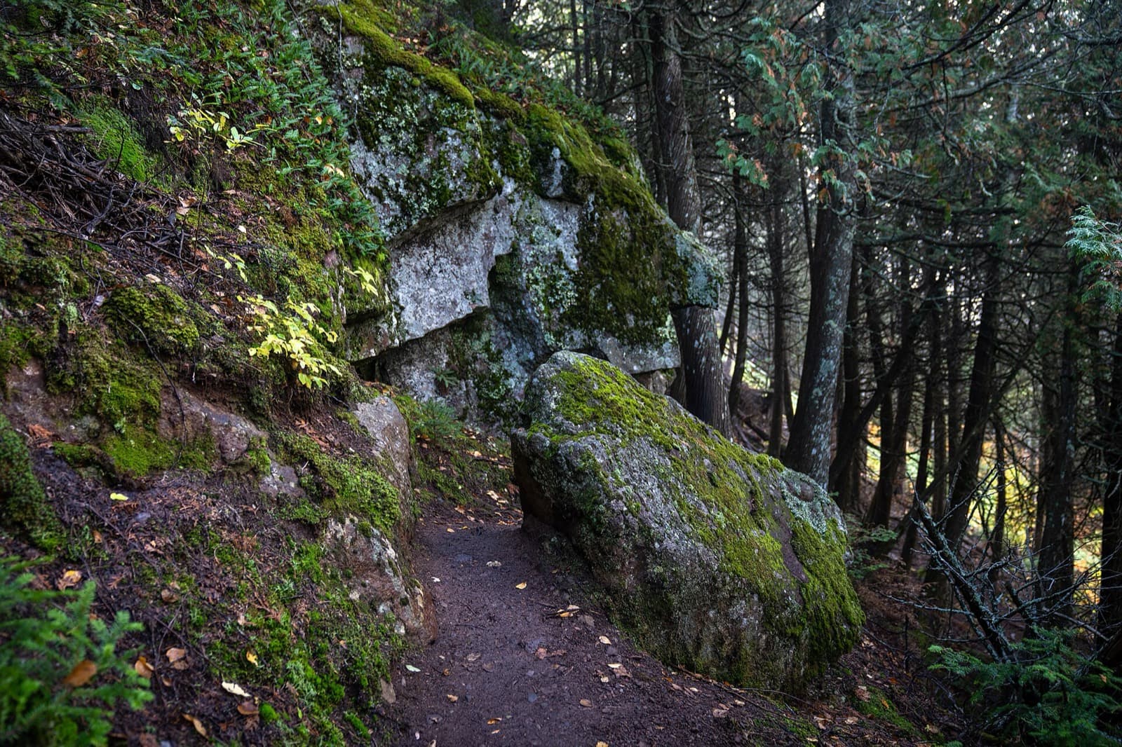
Superior Hiking Trail along Lake Superior and the Sawtooth ridges, with river crossings, boardwalks and overlooks. · Medium confidence
- Trail experienceGreat4.2
Runners love the trail but call it rugged and relentless, with constant roots and rocks. · Medium confidence
Course traits, not part of the score
- FootingTechnical1.5
About 95% single-track with constant roots, rocks, steep rock steps and mud on the Superior Hiking Trail. · High confidence
- RunnabilityLots of hiking2.0
5,288 m (17,350 ft) of gain on rugged footing means most runners hike much of it. · Medium confidence
- ClimbingHilly2.4
Climbs 169 ft per mi (32 m per km), from the official elevation gain. · High confidence
Conditions
Race-day temperature and how predictable the weather is. Counts for 14% of the overall score.
- Race-day temperatureWarm or cold3.4
Early September highs up to 29 °C (85 °F) and lows near 2 °C (35 °F); 2025 was pleasant and 2018 hot. · Medium confidence
- Weather reliabilityVariable2.6
Years range from dry and fast to muddy with torrential rain (2019, 2026), hot (2017, 2018) or cold at night. · Medium confidence
Course traits, not part of the score
- AltitudeSea level4.5
Peaks near 610 m (2,000 ft) beside Lake Superior. · High confidence
Cutoffs
How generous the overall and intermediate cutoffs are for the terrain. Counts for 13% of the overall score.
- Overall cutoffGenerous3.5
38 hours for 165.6 km (102.9 mi) is about 22 min per mile on very technical trail; 59% finished in 2026. · High confidence
- Intermediate cutoffsReasonable3.3
Cutoffs at 12 of 13 stations, strictly enforced; early ones are loose, but Oberg at mile 94 (151 km) stopped finishers in 2024. · High confidence
Intermediate cutoffs (2026 (participant guide); 2027 dates are tentative)
| Where | Distance | Cutoff |
|---|---|---|
| Split Rock, mile 8.5 | 14 km (8.5 mi) | 11:00 am Friday (3 hr) |
| Beaver Bay, mile 18.8 | 30 km (19 mi) | 2:20 pm Friday (6 hr 20 min) |
| Silver Bay, mile 23 | 37 km (23 mi) | 4:00 pm Friday (8 hr) |
| Tettegouche, mile 32.4 | 52 km (32 mi) | 7:40 pm Friday (11 hr 40 min) |
| County Road 6, mile 41 | 66 km (41 mi) | 10:40 pm Friday (14 hr 40 min) |
| Finland, mile 49 | 79 km (49 mi) | 2:10 am Saturday (18 hr 10 min) |
| Crosby-Manitou, mile 60.9 | 98 km (61 mi) | 9:10 am Saturday (25 hr 10 min) |
| Sugarloaf, mile 70.5 | 114 km (71 mi) | 12:10 pm Saturday (28 hr 10 min) |
| Cramer Road, mile 76 | 122 km (76 mi) | 1:45 pm Saturday (29 hr 45 min) |
| Temperance, mile 83 | 134 km (83 mi) | 4:00 pm Saturday (32 hr) |
| Sawbill, mile 88.3 | 142 km (88 mi) | 5:40 pm Saturday (33 hr 40 min) |
| Oberg, mile 93.9 | 151 km (94 mi) | 7:10 pm Saturday (35 hr 10 min) |
| Finish, Lutsen, mile 101 | 163 km (101 mi) | 10:00 pm Saturday (38 hr) |
Not part of the score
- First timer friendlyDemanding2.2
A 50 mi (80 km) finish is required, and the footing and 5,288 m (17,350 ft) of gain are demanding. · Medium confidence
- Getting inSells out2.6
Free January lottery, no waitlist, and a 50 mi (80 km) qualifier; the race says most new applicants get in within three tries. · High confidence
Stay and travel
Getting there, places to stay, race-day logistics and value. Counts for 8% of the overall score.
- Travel easeFair2.6
Duluth is the nearest airport to the start, then a long drive up the North Shore; Minneapolis is about 4 hours away. · Low confidence
- Places to stayBook early3.0
Caribou Highlands Lodge at the finish and Two Harbors near the start; the North Shore is busy in September, so book early. · Low confidence
- LogisticsFiddly2.2
Point to point with Thursday-only drop bags in Two Harbors and remote crewing. · Medium confidence
- ValueGood value3.8
$335 for a lottery-entry qualifier with 13 stations and about 400 volunteers; no refunds or transfers. · Medium confidence
Key facts
Checked against the 2026 (participant guide); 2027 dates are tentative edition on the official race site. Rules change, so confirm before you enter. Blank means the race does not publish it.
- Location
- Two Harbors (start) to Lutsen (finish), North Shore, Minnesota, United States
- Region
- Midwest US
- Typical month
- September
- Latest or next date
- 10 September 2027
- Start time
- 08:00
- First held
- 1991
- Distance
- 103 mi (166 km)
- Course shape
- Point to point
- Surface
- Trail: Rugged single-track with mud, roots, rocks, boardwalks, road crossings and steep drops.
- Footing
- Very technical for a 100: constant roots, rocks, steep rock steps and mud, with cliffs and drop-offs, and a rugged stretch of ridges through the Sawtooth Mountains. Reports say the Superior Hiking Trail is 'never fast'.
- Elevation gain
- 5,288 m (17,350 ft)
- Climbing rate
- 32 m per km (168 ft per mi)
- High point
- 610 m (2,000 ft)
- Overall cutoff
- 38 hours
- Pace to make the cutoff
- 22:12 per mi (13:48 per km)
- Cutoff notes
- Sonju (mile 56.7) has no cutoff. Cutoffs are strictly enforced and listed as subject to change. Runners must visit every aid station, including the 0.5 mi (0.8 km) spur at Finland. The 2024 Oberg cutoff stopped a 22-time finisher and a 2025 runner made it with minutes to spare.
- Aid stations
- 13
- Longest gap between aid
- 17 km (10 mi)
- Drop bags
- Some stations
- Crew access
- Many points
- Pacers
- Allowed after County Road 6 (mile 41 / 66 km); runners 65 and older may have a pacer at any time
- Support notes
- 13 aid stations plus the finish. The longest gap in the cutoff table is about 10.3 mi (16.6 km), Split Rock to Beaver Bay, and the guide warns some sections run 10 mi (16 km) without aid. Crew can reach all stations except Split Rock, Tettegouche and Sonju Lake Road, but roads are narrow remote gravel and cell coverage is poor; violations can bring a time penalty or disqualification. Drop bags accepted only on Thursday 5 to 8 pm in Two Harbors (not race morning), one per station at stations that take them, 15 x 10 x 7.5 in (38 x 25 x 19 cm). One pacer at a time from mile 41, two from Oberg to the finish. The race is cupless.
- Water crossings
- A few
- Water notes
- One shin-to-knee-deep Split Rock River crossing around mile 6.5 (10.5 km) in the 2026 guide; all other crossings have bridges or rock steps.
- Night running
- Most runners run through one night
- Mandatory gear
- No formal list. Race number on the outside front, chip on the back of the bib, water capacity to carry between stations, a cup (race is cupless), and allergy medicine such as an EpiPen if you have a known sting allergy. Lights and a rain jacket are recommended.
- Entry
- Lottery + qualifier
- Qualifier needed
- Finish a trail race of 50 mi (80 km) or more with published results, or a prior Superior 50K, Superior 50 mi, Moose Mountain Marathon or Superior 100, or 50+ mi in a timed event of 12 hours or less.
- Qualifies for
- Western States, UTMB Running Stones (6 points)
- Entry fee
- About $335
- Fee notes
- $335 plus UltraSignup fee, 2026 registration page.
- Field size
- About 295 runners
- Sells out
- months
- Finish rate
- 69% of starters in 2025
- Air temperature
- 2–29 °C (36–84 °F)
- Weather notes
- The guide says early September highs can reach the mid 80s F (about 29 C) and lows the mid 30s F (about 2 C); the average high is 65 F (18 C) and the average low 47 F (8 C). Years vary from hot to cold, wet and muddy to dry.
- Nearest airport
- DLH
- Stay notes
- Duluth is the nearest commercial airport to the start and Minneapolis is about four hours away (distances are not on the race site). The finish is at Caribou Highlands Lodge in Lutsen; drop bags and packet pickup are in Two Harbors on Thursday.
- Course record (men)
- 18:56:02 (Neal Collick, 2018; later editions not checked)
- Course record (women)
- 22:36:39 (Mallory Richard, 2018; later editions not checked)
Races like this
See every race ranked by likenessClosest on distance, course shape, climbing, footing, region and season.

Fort Valley (Caroline Furnace Camp, near Woodstock), VA
Also 100 mi · Point to point or one big loop · Similar climbing
Steamboat Springs, CO
Also 100 mi · Point to point or one big loop · Same time of year
Kaysville to Midway, UT
Also 100 mi · Point to point or one big loop · Similar footing
What runners and reviewers say
- Team RunRun (Ashley Nordell)Raced 2018 · blog · Positive
Second woman in 23:46 and 9th overall, rating it 10 out of 10. Rugged, rocky and technical with about 21,000 ft (6,400 m) of gain over 103.3 mi (166 km), and the rocks late in the race were her main challenge. Aid was standard, spaced up to about 10 mi (16 km), with crew access at nearly every station and a detailed crew packet. Praised the scenery, point-to-point format and organization.
“I give it a 10/10.”
- Ian Corless (Superior 100 2018)Raced 2018 · blog · Positive
Hot, clear and dry year with the trails in the best shape the writer had seen. Mostly single-track under tree cover with roots and rocks, over 6,400 m (21,000 ft) of climbing and descent, 13 aid stations and a 38 hour cutoff. Neal Collick set a course record of 18:56:02 and Mallory Richard 22:36:39.
- Ian Corless (Superior 100 2019)Raced 2019 · blog · Mixed
Dry, humid day followed by an evening torrential rainstorm that made the trail slick, slippery and muddy and caused pre-race favorites to fade or drop at Cramer Road and Sugarloaf. Winner Mick Jurynec ran 20:15:55.
- Ian Corless (Superior 100 2017)Raced 2017 · blog · Mixed
A hot day, a cold night and slippery, muddy trails; called gnarly and one of the more demanding US 100s with about 6,400 m (21,000 ft) of combined climb and descent and a 38 hour limit. Field capped at 250 then.
- Superior Fall Trail Race (2016 preview by Alex Kurt)Raced 2016 · article · Positive
Describes the 100 as impeccably marked and very scenic, with about 95% single-track and roots and rocks that punish runners expecting a fast course. The elevation profile is 'death by a thousand paper cuts' at about 21,000 ft (6,400 m). Weather has been cool, hot, muddy and dry across years; about 60% of the 100 mi field were first-timers.
Show 4 more
- Superior Fall Trail Race (2024 recap)Raced 2024 · article · Positive
Official 2024 recap: 238 started and 163 finished (about 68%). Race days were sunny and breezy in the 50s and 60s F (10 to 20 C) with overnight lows near 30 F (-1 C). The Oberg cutoff at mile 95.4 (153.5 km) ended a 22-time finisher's race. Trails were in good shape but 'never truly fast'.
- Superior Fall Trail Race (2025 recap)Raced 2025 · article · Positive
Official 2025 recap: 294 registered, 255 started, 176 finished (69%) and 79 DNF. Cold front brought brief light showers and most runners found conditions pleasant. The last finisher made the Oberg cutoff and finished in 37:55. The Split Rock loop was skipped for trail rehabilitation and about 400 volunteers helped.
- MPR News via St. Louis Public Radio (Jessie Diggins 2026)Raced 2026 · article · Positive
Retired Olympic skier Jessie Diggins won the women's race on her 100 mi debut in about 25 hours. Runners faced pouring rain through the night on a rocky, slippery trail. The race director said a 100 is really about grinding.
- MultiDayRunning listing (2026)Raced 2026 · aggregator · Mixed
Listing for the 2026 edition: 102.9 mi (165.6 km), 38 hour cutoff, 17,350 ft (5,288 m) of gain, and 151 of 256 starters finished according to an UltraRunning recap it cites. No runner reviews on the page.
Ran Superior 100 Mile (Superior Fall Trail Race)? Your notes on the footing, cutoffs and aid stations help the next runner decide.
Sources
Pages we used for facts and ratings.
Training for Superior 100 Mile (Superior Fall Trail Race)? Moku Coach builds your plan around race day.